Any visit to Uganda is incomplete without Hiking in Mgahinga National Park
Hiking on your way to the park, look out for small piles of stones in the garden fields. The local people call such a pile a ‘Gahinga’. Mount Gahinga is quite bigger than the average ‘gahinga’ but sitting next to Mount Muhavura does make it look small.
A hike, which takes you about, six hours round trip, goes through a good example of a pure Bamboo forest.
Gahinga once had a Crater Lake on top but time has changed it into a Lush swamp. Distance to the swamp is 8km.
Mt.Sabinyo (366m)
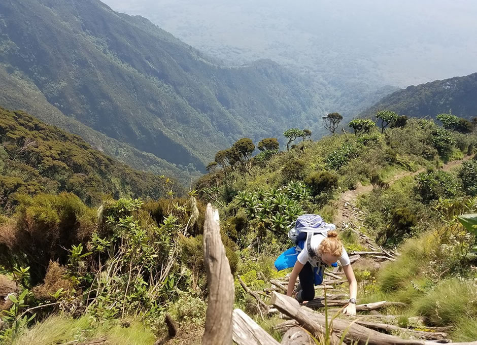
Like an old man, time has eroded Mt. Sabyinyo’s crown. This volcano offers 3 challenging peaks to climb.
A climb up the mountain takes one up a ridge along the eastern side of the climb to peak.
If you are to continue, the climb to the peak 111 involves walking a ridge with breath-taking drops into gorges of Rwanda and Uganda, a dual experience you will achieve here.
Finally, the hike up to the peak 111 is steep with several ladders and mush scrambling. You are guaranteed to get your hands dirty en-route to peak111! Once on top, you will be in Rwanda, Democratic Republic of Congo and Uganda, what a triple experience this is!!! The journey takes about eight hours round trip to cover the 14km stretch. Read more bout Mt.Sabinyo
Mt.Muhabura(4127m)
‘The Guide’ Seen from all over Kisoro, this volcano acts as a guide. The typical cone-shaped Mountain provides some of the best views in the country.
Much of the climb passes a rocky surface covered by grasses and small shrubs.
Once at the top, hikers are rewarded with the view of the Virunga volcanoes, Lake Edward in Queen Elizabeth Game Park, Bwindi and the peaks of Rwenzori Mountain.
The hike takes approximately 8 hours round trip covering 12km.
You are advised to camp at the Muhavura base camp the night before the site has no facilities so you need a tent, water, food and sleeping gear. Read more about Mt. Muhabura
Cave Exploration
Garama cave
This is one of the caves where once the crafty Batwa (who were warriors) lived and fought their neighbors, the Bantu.
The distance to the cave entrance from the park headquarters is 3 km long and it takes about 4 hours. Your guide will show you how the Batwa lived and fought out of the cave.
The cave is 342m in length and 14m deep, and is now inhabited only by bats. Read more about the Garama Cave
Viewing Platform:
This is about 800 metres from the Park gate. Once on top, you will have a good view of the Park and the surrounding areas. A guide is not necessary and the activity is free. Displaying panels at the hill point will give some information about what you can see.
Border Trail – Visa Not Required
This hike takes you first toward Sabinyo. The trail climbs up the base of Sabinyo for a while through fine montane forest before turning toward the Congo.
Along the way you will get a great view of Sabinyo’s gorge and peaks. Upon reaching the Congo you cut back along the international border.
The return leg to the Park Head Quarters is a great section for birding. The two rest huts along the way are good places for a break. Look closely for the golden monkeys and signs of elephants. Climbing time is 5 hours and distance 10 km.